

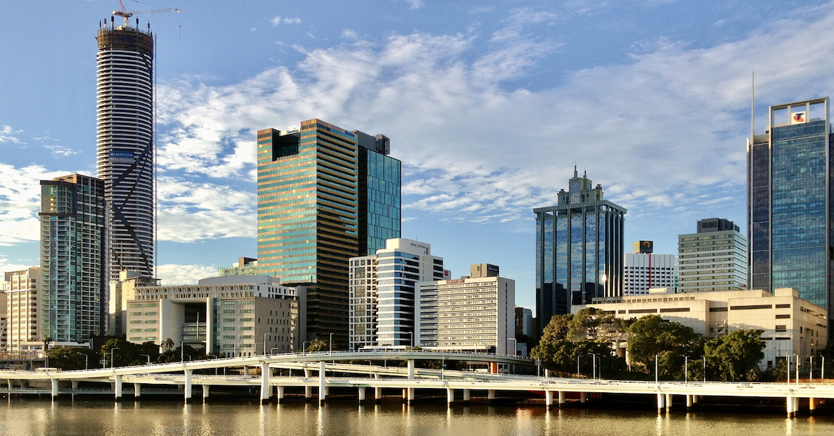
At the southern tip of Lower River Terrace, a network of walking paths and parklands quietly unfolds beneath the towering concrete belly of the Captain Cook Bridge. Above, thousands of motorists hustle along the M3, crossing the Brisbane River directly into the mouth of the Riverside Expressway.
This specific junction is where the leafy riverside of Kangaroo Point collides with one of Brisbane’s busiest transit corridors.

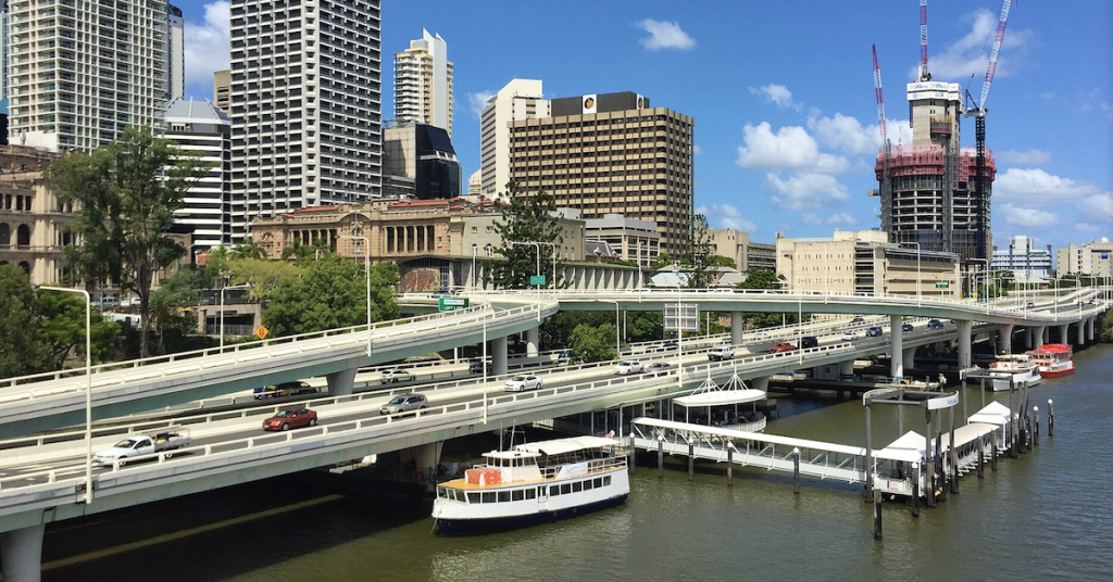
On 22 July 2026, the Riverside Expressway officially marks its 50th anniversary. While the vast majority of this elevated highway hugs the edges of the CBD, its southern terminus is permanently anchored to Kangaroo Point via the Captain Cook Bridge.
For residents, cyclists, and pedestrians, this massive infrastructure isn’t a distant freeway; it is a towering neighbor built right alongside their riverfront boardwalks, parks, and apartment complexes.


The Motorway Meets the Suburb
The Captain Cook Bridge serves as the critical link, carrying the Pacific Motorway over the water and depositing it straight onto the Riverside Expressway. While the bridge opened first in 1972, the completion of the expressway four years later forged an unbroken highway system across the city’s edge.

This physical footprint roots Kangaroo Point firmly in the expressway’s 50-year history. The infrastructure doesn’t just affect local commuters; it actively reshapes the suburb’s landscape. The Kangaroo Point Bikeway snakes from Thornton Street right up to the bridge, where it meets the popular Cliffs Boardwalk winding from the Riverlife Adventure Centre.
This tight wedge of land on Lower River Terrace is a masterclass in shared urban space. It serves as the northern launchpad for Veloway 1 (V1)—the major dedicated bicycle highway running south—meaning that within just a few square meters, a major interstate motorway, dense residential apartments, and vital recreational corridors all coexist.
A Radical Plan to Beat 1960s Gridlock
By the mid-1960s, Brisbane’s narrow inner-city streets were choking under a growing volume of automobiles. To solve the crisis, American consulting engineering firm Wilbur Smith and Associates drafted the groundbreaking 1965 Brisbane Transportation Study. Their solution was to bypass the inner-city grid entirely by building an elevated expressway right over the Brisbane River.


Construction kicked off in 1968, a massive engineering feat that slowly draped concrete spans along the northern riverbank. On 22 July 1976, Queensland Governor Sir Colin Hannah officially opened the final 1.4-kilometre leg to a crowd of 300 guests.
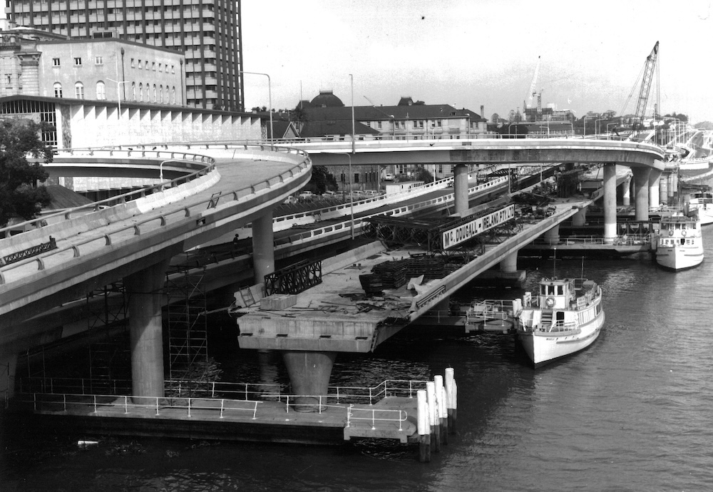
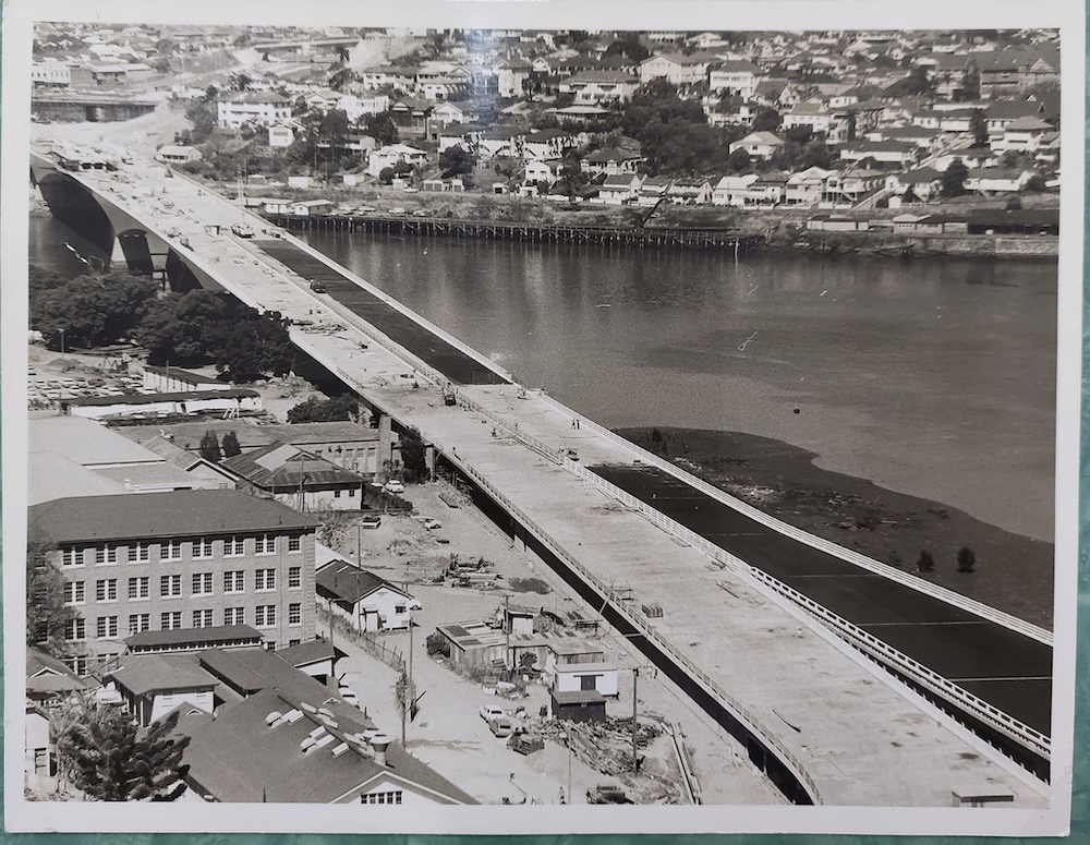
The ambitious $37 million project wasn’t without controversy. During the opening ceremony, a small band of conservationists staged a protest from the riverbank below. According to State Library of Queensland records, a Main Roads truck was deliberately parked in front of the demonstrators to block their signs from view—prompting the protesters to simply pick up their banners and march to a more visible spot.
The 2006 Closure: When the City Stooped to a Halt
Because Kangaroo Point shares such intimate space with the corridor, any hiccup on the expressway instantly reverberates through the suburb’s local streets. This vulnerability was starkly exposed during an emergency shutdown in October 2006.
During routine maintenance, inspectors discovered misaligned deck sections and a hairline 0.04-millimeter crack on the Ann and Alice Street ramps. Erring on the side of caution, authorities immediately shuttered the expressway between Elizabeth and Hale streets. While the main lanes reopened three days later once engineers deemed the structure underneath safe, the brief closure triggered an absolute gridlock:
- Local Bottlenecks: A subsequent network analysis report revealed that traffic skyrocketed by 19 per cent at the intersection of River Terrace and Main Street in Kangaroo Point as drivers scrambled for alternative routes.
- The Wider Ripple: Gridlock bled across the city onto Coronation Drive, Bowen Bridge Road, and various river crossings, while traffic on the Pacific Motorway itself plummeted as drivers actively avoided the city.
- Mass Commuter Detours: An estimated 41,000 commuters had to alter their daily routines. Drivers delayed, staggered, or cancelled trips entirely, while thousands abandoned their cars to walk, cycle, or catch trains and buses.
Astonishingly, 40 per cent of those caught in the chaos didn’t even plan on crossing the river. The crisis proved that when the expressway goes down, local suburban streets bear the brunt of a gridlocked city.
Fifty Years of Coexistence
The sheer volume of traffic highlights the corridor’s immense role in Brisbane’s daily life. State data from 2019 indicated that the Captain Cook Bridge was already carrying over 120,000 vehicles every single weekday, cementing it as one of the state’s busiest structures—a number that has only climbed as Brisbane approaches the late 2020s.
As Brisbane celebrates 50 years of the Riverside Expressway on 22 July 2026, the anniversary carries a unique meaning for Kangaroo Point. It isn’t just a celebration of civil engineering or commuter convenience; it marks a half-century of a suburb intimately sharing its borders, its air, and its riverfront with the beating heart of Brisbane’s transit network.
Published 14-July-2026