


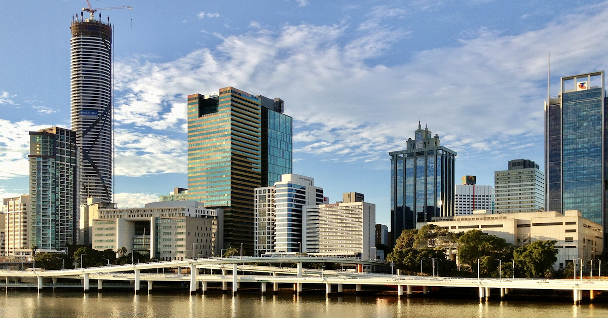
Riverside Expressway at 50: The Vital Road Beside Kangaroo Point

At the southern tip of Lower River Terrace, a network of walking paths and parklands quietly unfolds beneath the towering concrete belly of the Captain Cook Bridge. Above, thousands of motorists hustle along the M3, crossing the Brisbane River directly into the mouth of the Riverside Expressway.


This specific junction is where the leafy riverside of Kangaroo Point collides with one of Brisbane’s busiest transit corridors.

On 22 July 2026, the Riverside Expressway officially marks its 50th anniversary. While the vast majority of this elevated highway hugs the edges of the CBD, its southern terminus is permanently anchored to Kangaroo Point via the Captain Cook Bridge.

For residents, cyclists, and pedestrians, this massive infrastructure isn’t a distant freeway; it is a towering neighbor built right alongside their riverfront boardwalks, parks, and apartment complexes.

The Motorway Meets the Suburb

The Captain Cook Bridge serves as the critical link, carrying the Pacific Motorway over the water and depositing it straight onto the Riverside Expressway. While the bridge opened first in 1972, the completion of the expressway four years later forged an unbroken highway system across the city’s edge.

This physical footprint roots Kangaroo Point firmly in the expressway’s 50-year history. The infrastructure doesn’t just affect local commuters; it actively reshapes the suburb’s landscape. The Kangaroo Point Bikeway snakes from Thornton Street right up to the bridge, where it meets the popular Cliffs Boardwalk winding from the Riverlife Adventure Centre.

This tight wedge of land on Lower River Terrace is a masterclass in shared urban space. It serves as the northern launchpad for Veloway 1 (V1)—the major dedicated bicycle highway running south—meaning that within just a few square meters, a major interstate motorway, dense residential apartments, and vital recreational corridors all coexist.

A Radical Plan to Beat 1960s Gridlock

By the mid-1960s, Brisbane’s narrow inner-city streets were choking under a growing volume of automobiles. To solve the crisis, American consulting engineering firm Wilbur Smith and Associates drafted the groundbreaking 1965 Brisbane Transportation Study. Their solution was to bypass the inner-city grid entirely by building an elevated expressway right over the Brisbane River.

Construction kicked off in 1968, a massive engineering feat that slowly draped concrete spans along the northern riverbank. On 22 July 1976, Queensland Governor Sir Colin Hannah officially opened the final 1.4-kilometre leg to a crowd of 300 guests.
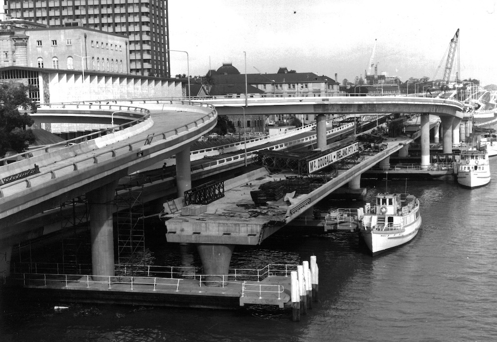
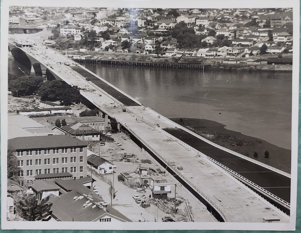
Photo Credit: 100 Years TMR
Photo Credit: Alison Greer/Facebook

The ambitious $37 million project wasn’t without controversy. During the opening ceremony, a small band of conservationists staged a protest from the riverbank below. According to State Library of Queensland records, a Main Roads truck was deliberately parked in front of the demonstrators to block their signs from view—prompting the protesters to simply pick up their banners and march to a more visible spot.

The 2006 Closure: When the City Stooped to a Halt

Because Kangaroo Point shares such intimate space with the corridor, any hiccup on the expressway instantly reverberates through the suburb’s local streets. This vulnerability was starkly exposed during an emergency shutdown in October 2006.

During routine maintenance, inspectors discovered misaligned deck sections and a hairline 0.04-millimeter crack on the Ann and Alice Street ramps. Erring on the side of caution, authorities immediately shuttered the expressway between Elizabeth and Hale streets. While the main lanes reopened three days later once engineers deemed the structure underneath safe, the brief closure triggered an absolute gridlock:

  • Local Bottlenecks: A subsequent network analysis report revealed that traffic skyrocketed by 19 per cent at the intersection of River Terrace and Main Street in Kangaroo Point as drivers scrambled for alternative routes.
  • The Wider Ripple: Gridlock bled across the city onto Coronation Drive, Bowen Bridge Road, and various river crossings, while traffic on the Pacific Motorway itself plummeted as drivers actively avoided the city.
  • Mass Commuter Detours: An estimated 41,000 commuters had to alter their daily routines. Drivers delayed, staggered, or cancelled trips entirely, while thousands abandoned their cars to walk, cycle, or catch trains and buses.

Astonishingly, 40 per cent of those caught in the chaos didn’t even plan on crossing the river. The crisis proved that when the expressway goes down, local suburban streets bear the brunt of a gridlocked city.
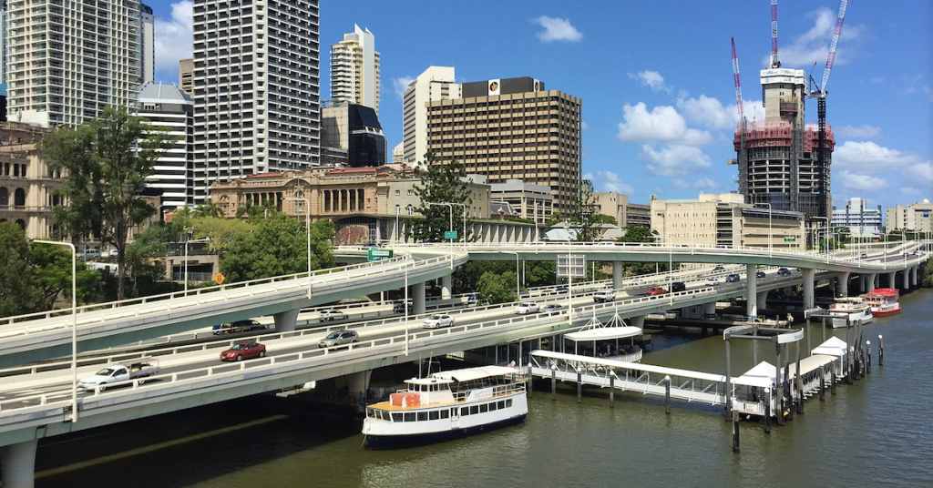
Fifty Years of Coexistence

The sheer volume of traffic highlights the corridor’s immense role in Brisbane’s daily life. State data from 2019 indicated that the Captain Cook Bridge was already carrying over 120,000 vehicles every single weekday, cementing it as one of the state’s busiest structures—a number that has only climbed as Brisbane approaches the late 2020s.


As Brisbane celebrates 50 years of the Riverside Expressway on 22 July 2026, the anniversary carries a unique meaning for Kangaroo Point. It isn’t just a celebration of civil engineering or commuter convenience; it marks a half-century of a suburb intimately sharing its borders, its air, and its riverfront with the beating heart of Brisbane’s transit network.

Published 14-July-2026
Preliminary Designs Released for New Kangaroo Point Bikeway Along Shafston Avenue

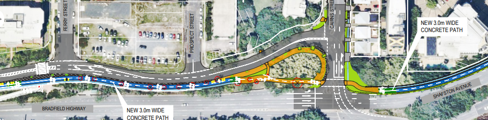
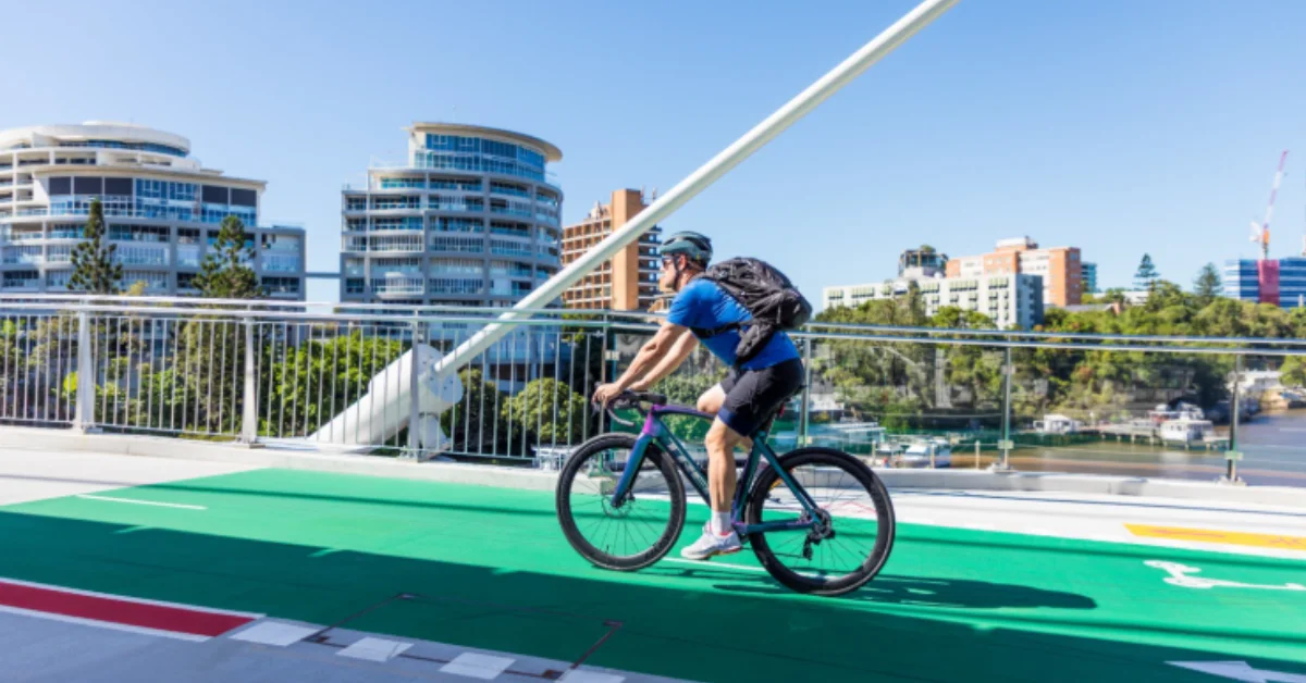
Brisbane City has released preliminary designs for a new separated bikeway along Shafston Avenue, extending the active travel corridor already established by the Kangaroo Point Bridge.


Read: Kangaroo Point to Anchor Major CityLink Cycleway Expansion


The 1.2-kilometre Shafston Avenue Bikeway will run between Deakin Street at Kangaroo Point and Mowbray Park at East Brisbane, delivering a two-way cycleway and a separate footpath along a stretch long identified as difficult and dangerous for cyclists.

Shafston Avenue Bikeway Preliminary Design (Photo credit: BCC)

Plans released ahead of the 2026-27 budget showed dedicated lanes for cyclists travelling in each direction and a third lane reserved for pedestrians. Several pedestrian crossings are also planned, including at Thorn Street and Castlebar Street.

Photo credit: BCC

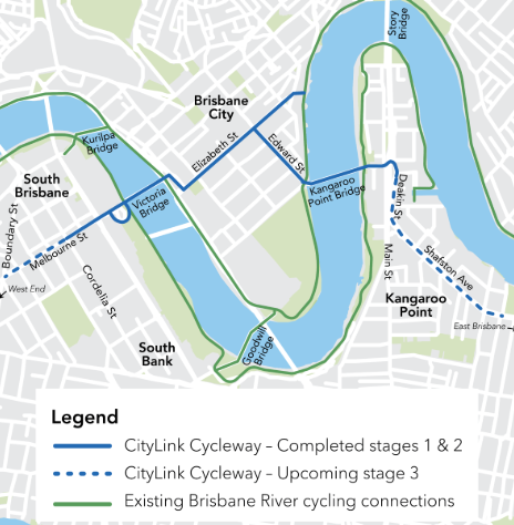
The project forms part of Stage 3 of the CityLink Cycleway program, jointly funded under a 50-50 agreement with the state, through the Cycle Network Local Government Grant program. The final design is expected to be released late in 2026, with construction scheduled to begin in 2027. Costs have not yet been confirmed.

A gap that needed filling

Cyclists travelling between the eastern suburbs and the CBD have long flagged Shafston Avenue as a problem stretch. Norman Park retiree Richard Boys, who regularly rides toward the city, described the avenue as the roughest part of his route and said a proper bikeway would give him a continuous and safer link through to the inner city.

Belinda Ward, a spokesperson for cyclist advocacy group East BUG, said the upgrade was long overdue. East BUG was among the groups consulted during the planning process, with early designs initially proposing a shared path before being revised to include the separated bikeway and footpath that feature in the current preliminary plans.

Ward said the eastern suburbs had been overlooked for a long time, and while the Shafston Avenue project was a positive step, there remained much more to be done. She noted that past announcements had not always translated into action, and said what mattered most now was seeing construction actually get underway.

What the project will deliver

Photo credit: BCC

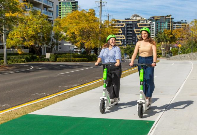
Once complete, the bikeway will create a direct and safer route between the eastern suburbs and the city via the Kangaroo Point Bridge, improving the connection for people walking, riding and scooting. The upgrade is part of a broader expansion of the CityLink Cycleway, which also includes a planned extension of the existing bikeway along Melbourne Street in South Brisbane, connecting the recent Victoria Bridge to Cordelia Street link through to Boundary Street in West End.

Stages 1 and 2 of the CityLink Cycleway became permanent in 2022 following a successful trial period.

Cr Adrian Schrinner said the project was about keeping pace with the city’s growth. “As our city grows, we need a transport network that makes active travel easier, helping residents leave their cars at home and reducing congestion on our roads,” he said.

Council infrastructure chair Ryan Murphy said the bikeway would give residents safer, easier travel options as Brisbane continues to grow.

Brisbane also highlighted the detailed planning behind the design. “Shafston Avenue is a busy and important road for all modes of travel travelling to and from the eastern suburbs. We have completed detailed traffic modelling to help us make balanced changes to intersections and local traffic access to include safe and efficient movements for people walking and riding. This work will help all of our community get home sooner and safer.”

A project years in the making

The Shafston Avenue corridor has attracted various proposals over the years. In 2020, a $22.5 million plan was announced to close gaps in the Riverwalk at Kangaroo Point and create an unbroken path linking Kangaroo Point and Mowbray Park. In 2024, a separate $35 million proposal was put forward to upgrade the existing bike route along Shafston Avenue into a separated cycleway.


Read: Kangaroo Point Bridge Opening to Boost Brisbane Connectivity


The current project builds on those earlier proposals, with a preliminary design now public and a construction timeline confirmed.

More information on the Shafston Avenue Bikeway is available at brisbane.qld.gov.au. 

Published 16-June-2026

Kangaroo Point Bikeway Planning Study: Charting a Path to Better Connectivity

Updates from Council are due to be released anytime soon, on key themes from community inputs and next steps for the Kangaroo Point Bikeway, from Captain Cook Bridge to Thornton Street. The project focuses on enhancing connectivity, safety, and accessibility within the Brisbane Bicycle Network.


The project encompasses the stretch located at the corner of Lower River Terrace (opposite the Veloway 1 bikeway), traversing through Kangaroo Point Cliffs Park, and extending along the boardwalk and river’s edge pathways to Thornton Street.  It examines various technical aspects, including anticipated benefits, site constraints, impacts, costs, risks, and opportunities for improvement.

This study represents a collaborative effort between Brisbane City Council and the Queensland Government, supported by the Cycle Network Local Government Grants program.

Kangaroo Point Bikeway
Photo Credit: Unsplash

The Kangaroo Point Bikeway is a crucial inner-city active travel artery, holding a prominent place within Brisbane’s Bicycle Network. It facilitates connections between Kangaroo Point, the Central Business District (CBD), South Bank, and other key destinations. 

This route is highly favoured by both commuters and recreational travellers, serving people of all ages and abilities. It links major residential areas to essential hubs such as public transport nodes, universities, schools, shopping precincts, commercial centres, and recreational facilities. The Kangaroo Point Green Bridge, currently under construction, will further enhance this connectivity.

Following the consultation period that culminated in October 2023, Brisbane City Council has yet to provide an update outlining the next steps for this project.

It is important to note that construction funding has yet to be confirmed for future phases of this project.


For additional information on this project, contact the project team at 1800 669 416 during business hours or Brisbane City Council’s Contact Centre at 3403 8888, available 24 hours a day.

Published 3-Jan-2024

Kangaroo Point Bikeway Now Has Bicycle Awareness Monitors

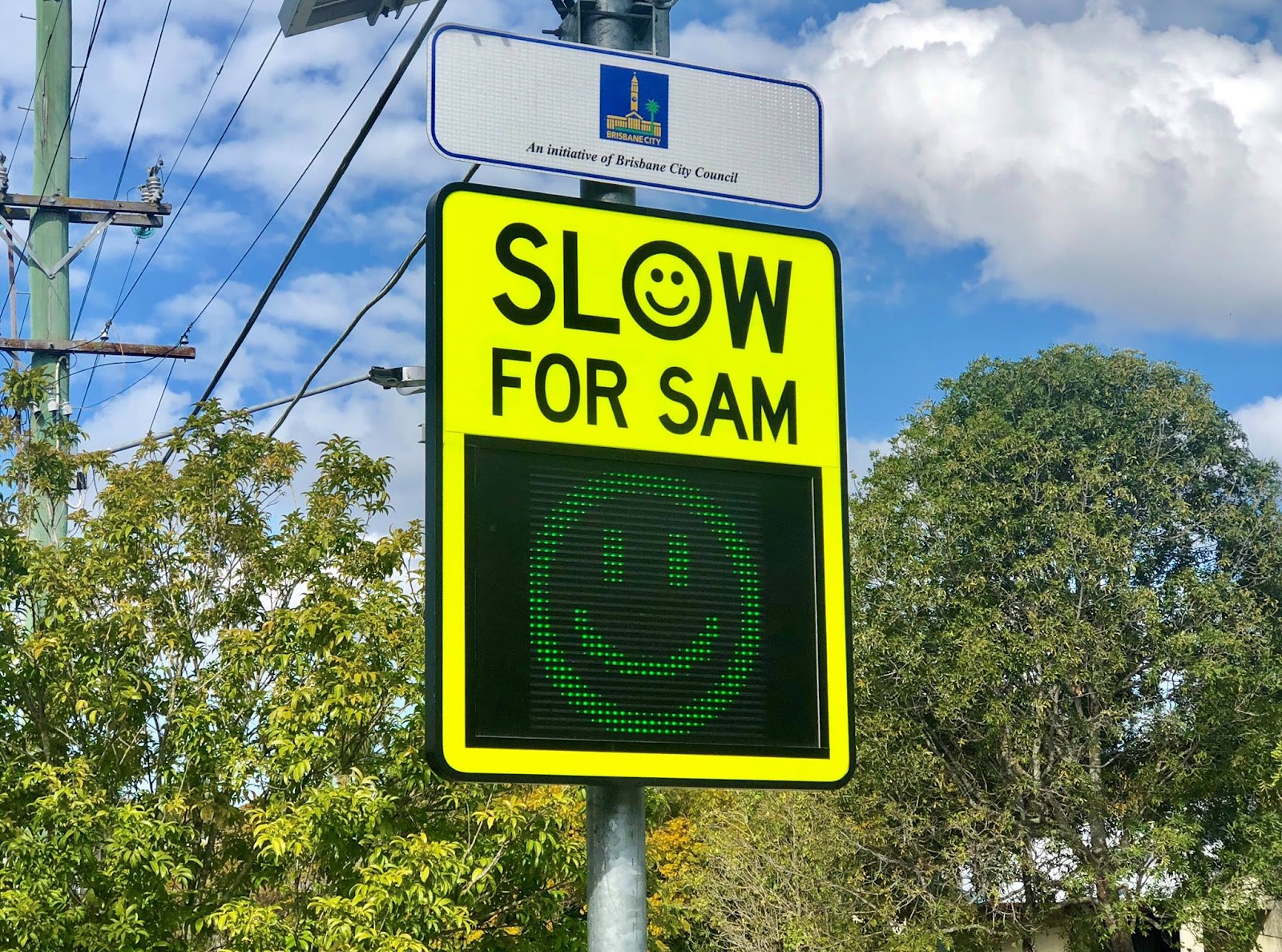
Bicycle Awareness Monitors have been installed at the Kangaroo Point Bikeway to remind cyclists and e-mobility riders to slow down. 


Read: Two Dining Destinations Planned for Kangaroo Point Green Bridge Site


These new signs will alert approaching riders of their speed and indicate if their speed is below or above 15 km/h.

The Bicycle Awareness Monitors work just like the city’s Speed Awareness Monitors, which flashes a sign when drivers are over or under speeding. 

kangaroo point bikeway
Photo credit: Brisbane City Council/Facebook

A thank you message flashes when vehicles are travelling at or below the speed limit, whilst a ‘slow down’ reminder will be displayed if a driver is overspeeding.

Lord Mayor Adrian Schrinner said they have turned on two signs designed to measure the speed of passing bicycles, as well as e-scooters and e-skateboards, along the bikeway.

Cr Schrinner said the two signs could be found near the Kangaroo Point Cliff stairs and near the Riverlife Adventure Centre along the shared Kangaroo Point Cliffs path.

The Kangaroo Point Bikeway is being used by about 3,000 people cycling, walking, or riding a day.

Photo credit: Cr Vicki Howard

“Brisbane is an incredible city to walk and ride around, but it’s important everyone uses our shared paths considerately and safely and travelling at the correct speed is an important part of this,” Cr Schrinner said.

Cr Schrinner encourages everyone to keep an eye out for the new signs and know that if they are travelling at a safe speed they will be rewarded with a smile and a thank you message.


Read: 200-Million-Year-Old Tree Stump Unearthed During Cross River Rail Tunnelling At Kangaroo Point


The signs operate entirely via solar power,which means they are not only better for the environment but also helps reduce ongoing costs. 

If proven successful in delivering positive change in drivers’ behaviour during the trial, Brisbane City Council will explore options to install them on other pathways across the city. The trial is expected to end by February 2023.

Stage 1 of Kangaroo Point Bikeway Upgrade Project Nears Completion

Finalisation works on Stage 1 of Kangaroo Point Bikeway upgrade from Goodwill Bridge to Veloway 1 are nearing completion, according to a progress update from the Brisbane City Council.

The Kangaroo Point Bikeway upgrade Stage 1 project is part of the Council’s congestion-busting Better Bikeways 4 Brisbane program, delivered in stages 1A, 1B, and 1C, and is expected to be completed this mid-2019.

Construction of Stage 1A started in June 2018 which involved upgrade works done along Lower River Terrace from Veloway 1 connection at the Pacific Motorway underpass to the Dock Street and Little DOck Street intersection.

Improvements and features of Stage 1A include a new four-metre-wide bi-directional bikeway extending 320 metres along Lower River Terrace and Dock Street; pedestrian paths and access enhancements; tree planting and landscaping; and an improved bicycle crossing at the Lower River Terrace and the V1 intersection.

Photo Credit: Brisbane City Council / brisbane.qld.gov.au

Upgrade works from the intersection of Little Dock Street and Dock Street to Goodwill Bridge is continued on in Stage 1B, which began in early 2019. 

Features and improvements of Stage 1B include the installation of a “shared street”, a paved roadway surface at the shared zone, and a raised zebra crossing points, as well as the construction of an improved pedestrian and cyclist facilities beside the Griffith University Film School and the removal of the cycle ramp and redirection of cyclists to the new dedicated bikeway. 

Photo Credit: Brisbane City Council / brisbane.qld.gov.au

Stage 1C involves the upgrading of Dock Street and Vulture Street intersection where the Woolloongabba and Kangaroo Point Bikeways will meet. Aside from footpath upgrades and landscaping, other improvements include increasing the size of the concrete traffic island on Dock Street and building out the kerb on the western side of Dock Street.

Funding for the upgrade project between the Council and the Cycle Network Local Government Grants program of the Queensland Government, with the state government contributing half of the funding.